

An article in the Monmouthshire Merlin in the 10th March, 1832 discusses the boundaries of the counties of Monmouth, Brecknock and Glamorgan and is described as being an extract from the "Bill to settle and describe the Divisions of Counties, and the Limits of Cities and Boroughs, in England and Wales, in so far as respects the Election of Members to serve in Parliament".
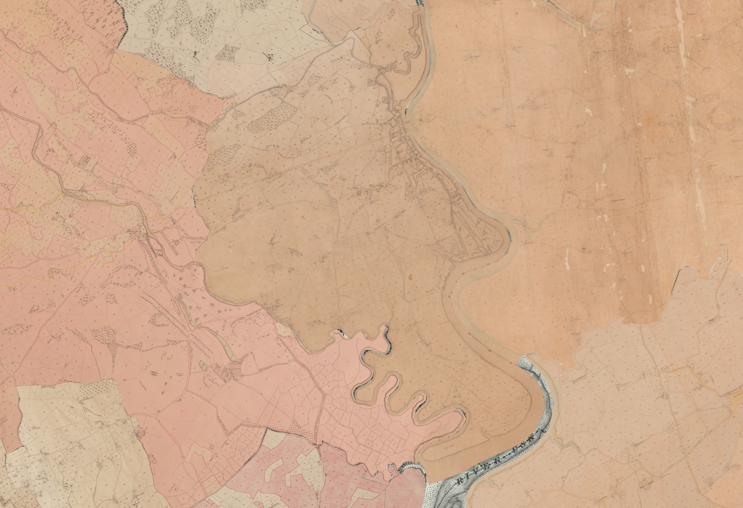
As a comparison and to cross-reference the article, The National Library of Wales has a very detailed tithe map covering the entirety of Wales from around 1840 so is unlikely to have changed much since the article was published.
Click to view the Newport tithe map
It shows the boundary largely following the course of the River Usk. The southern, eastern and northern portions of the boundary match the description in the Monmouthshire Merlin but the article seems to indicate it straying across to Caerleon Road/Christchurch Road and down to Liswerry Pill.
The Article
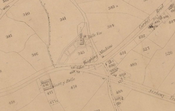
"From the point, on the south of the town, at which the Mendle Gief road is joined by a husbandry road, leading to Hundred Acres Gout, along the Mendle Gief road, to the point at which the same meets the Cardiff road; thence, westward, along the Cardiff road to the point at which the same meets the streamlet from Cwrt-y-bella Well..."
"...thence along the said streamlet to the pool on the western side of Friar's garden wall; thence along the water-course up from the said pool to another pool on the western side of Bull-field; thence along the western fence of Bull-field to the point at which the same fence, cuts the road from Stow to Risca; thence, westward, along the road from Stow to Risca to the point at which the same is cut by the fence which runs northward from the east end of the cottages belonging to John Ricketts..."
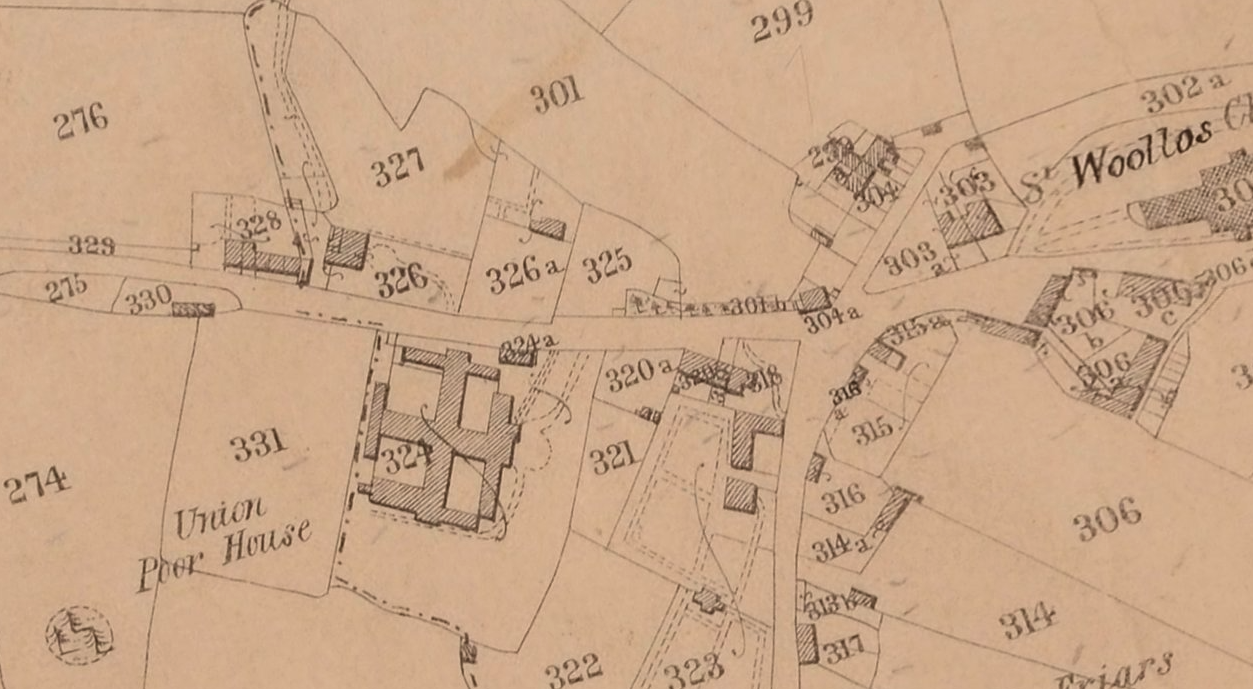
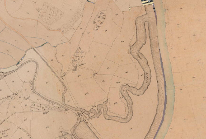
"...thence along the last-mentioned fence to the north-western corner of the field of which it is the western boundary; thence, eastward, along the northern fence of the last-mentioned field to the point at which the same is intersected by the fence of the adjoining field; thence, north-ward, along the last-mentioned fence to a well head; thence along the stream leading therefrom to the point at which the same meets the boundary of the old borough thence along the boundary of the old borough to the point at which the same meets the river Usk at the mouth of Crindau Pill..."
"...thence along the river Usk to the point at which the same is joined by a pill opposite the castle; thence along the said pill to the gout; thence along the water-course in a direction nearly due east, to the point at which the same meets the new road to Caerleon; thence along the new road to Caerleon to the point at which the same joins the old road to Christ Church; thence along the new reen to the point at which the same meets Liswerry Pill thence along Liswerry Pill to the point at which the same joins the river Usk; thence along the river Usk to the point at which the same is joined by Hundred Acres Gout; thence along Hundred Acres Gout to the point at which the same is met by the said husbandry road, leading thereto from the Mendle Gief road; thence along the said husbandry road to the point first described. "


Member discussion